Call 01678 521083
The River
THE RIVER
RIVER GUIDE
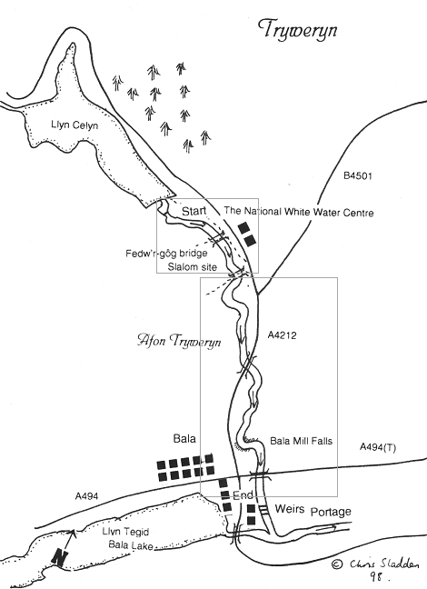
The Afon Tryweryn is split in to 2 sections, the Upper River and the Lower River. The Upper River is roughly 2km of grade 3-4 rapids and runs alongside the centre. The Lower section begins below the centre alongside Tyn Cornel campsite and continues with grade 2-3 rapids 6km down to Bala car park. There is one grade 4 rapid near the end of this section which is easily portaged using the leat; please ask for details in reception if you wish to use this or look out for the leat signs river right before Bala Mill Falls.
NATURAL HAZARDS
We do our best to ensure the Upper and Lower Tryweryn are free of obstructions, however it is a natural environment so please be aware of any dangers and let the centre know if you spot any new obstructions. When you sign in at reception please check the water information board for details of any known hazards.
INVASIVE NON-NATIVE SPECIES


Canolfan Tryweryn, Frongoch, Bala, Gwynedd, LL23 7NU | Company No. 8282630. VAT No. 115151262